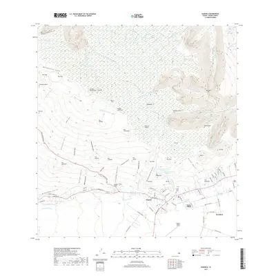
2017 Map of Kamuela
USGS Topo · Published 2017About this map
The Kohala Mountains define the northern expanse of this 2017 survey, where a complex network of streams and ditches feeds into the deep Waimanu Valley. The settlement of Waimea serves as the primary hub, surrounded by smaller communities like Kuhio Village and Pū'ōpelu. This area demonstrates a sophisticated water management system necessary for the high-elevation landscape, evidenced by the Upper Hamakua Ditch, Puu Iki Ditch, and the twin Waikoloa Reservoirs. At the southern end, the Waimea-Kohala Airport and several farm roads, including Lalamilo Farm Rd, suggest a mix of modern infrastructure and agricultural utility. Local history is anchored by sites like the Imiola Church Cem, while the rugged transition from peak to gulch is traced through features such as Lanikepu Valley and the Walaka Bridge.
Find a feature on this map
114 named features on this map. Tap any name to fly to it.
Don’t see what you’re looking for? This feature index may not catch every label — zoom into the map to look around manually.
Map Details
Editions of this 2017 Kamuela Map
This is the sole edition of this map. No revisions or reprints were ever made.
Other maps of this area

1913 · Kohala
USGS Topo · 1:62,500

1916 · Kohala
USGS Topo · 1:62,500

1916 · Waipio
USGS Topo · 1:62,500

1928 · Puako
USGS Topo · 1:62,500

1954 · Hawaii North
USGS Topo · 1:250,000

1956 · Puu Hinai
USGS Topo · 1:24,000

1956 · Kamuela
USGS Topo · 1:24,000

1956 · Nohonaohae
USGS Topo · 1:24,000

1956 · Makahalau
USGS Topo · 1:24,000

1956 · Kawaihae
USGS Topo · 1:24,000