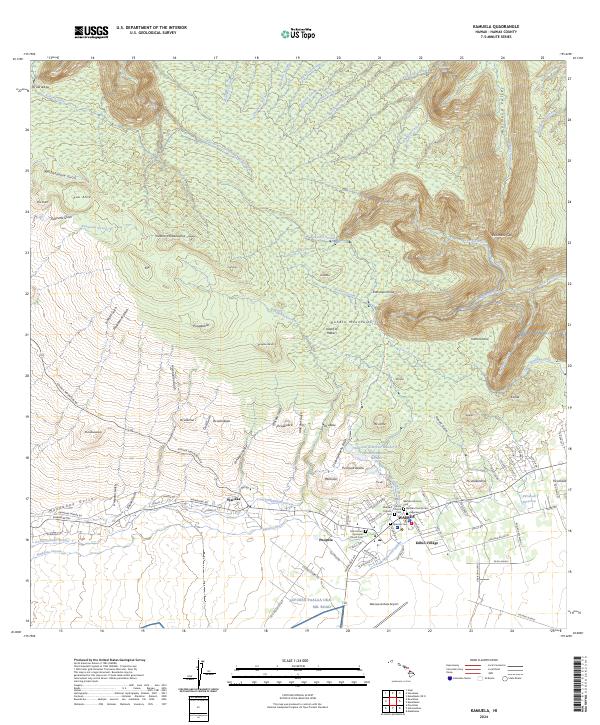
2024 Map of Kamuela
USGS Topo · Published 2024About this map
Waimea and its surrounding ranchlands sit at the southern foot of the Kohala Mountains on the Island of Hawai'i. This 2024 survey captures the distinct transition from the dense residential grid of Kūhiō Village and the historic core near Imiola Church to the deep, weathered gulches of the northern slopes. The landscape is defined by its complex water management systems, including the Kehena Ditch and the Upper Hāmākua Ditch, which redirect flow across the high plateaus. Genealogists will find significant detail in the clustering of community sites like the Japanese Cem and Spenser Cem near the town center. The presence of the Pupukea Paalaa Uka Mil Road and Waimea-Kohala Airport highlights the region's importance as a central transportation and infrastructure hub for the northern part of the island.
Find a feature on this map
121 named features on this map. Tap any name to fly to it.
Don’t see what you’re looking for? This feature index may not catch every label — zoom into the map to look around manually.
Map Details
Editions of this 2024 Kamuela Map
This is the sole edition of this map. No revisions or reprints were ever made.
Other maps of this area

1913 · Kohala
USGS Topo · 1:62,500

1916 · Kohala
USGS Topo · 1:62,500

1916 · Waipio
USGS Topo · 1:62,500

1928 · Puako
USGS Topo · 1:62,500

1954 · Hawaii North
USGS Topo · 1:250,000

1956 · Puu Hinai
USGS Topo · 1:24,000

1956 · Kamuela
USGS Topo · 1:24,000

1956 · Nohonaohae
USGS Topo · 1:24,000

1956 · Makahalau
USGS Topo · 1:24,000

1956 · Kawaihae
USGS Topo · 1:24,000