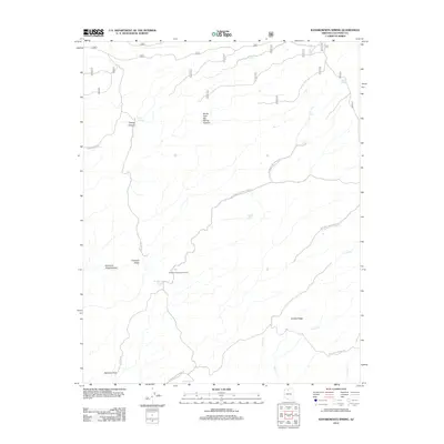
2012 Map of Kanabownits Spring
USGS Topo · Published 2012About this map
Kanabownits Lookout Tower stands as a focal point for this portion of the Kaibab Plateau, overseeing a high-elevation landscape defined by isolated springs and complex drainage systems. The terrain is marked by significant topographical features such as the Shinumo Amphitheater and Crescent Ridge, where the plateau begins its descent into deeper canyons. A network of specialized forest and park roads, including Swamp Ridge Rd and the Kanabownits Lookout Tower Rd, provides access to these remote heights. Water sources are critical landmarks here, represented by several named points like Tipover Spring, Fawn Spring, and the unique perched waters of Coffee Lake. The map details the headwaters of several drainages, including Crystal Cr and Milk Cr, as they carve through Crystal Ridge.
Find a feature on this map
22 named features on this map. Tap any name to fly to it.
Don’t see what you’re looking for? This feature index may not catch every label — zoom into the map to look around manually.
Map Details
Editions of this 2012 Kanabownits Spring Map
This is the sole edition of this map. No revisions or reprints were ever made.
Other maps of this area

1886 · Kaibab
USGS Topo · 1:250,000

1903 · Bright Angel
USGS Topo · 1:48,000

1906 · Bright Angel
USGS Topo · 1:48,000

1953 · Grand Canyon
USGS Topo · 1:250,000

1957 · Grand Canyon
USGS Topo · 1:250,000

1958 · Grand Canyon
USGS Topo · 1:250,000

1960 · Grand Canyon
USGS Topo · 1:250,000

1962 · Bright Angel
USGS Topo · 1:48,000

1962 · De Motte Park
USGS Topo · 1:62,500

1962 · Havasupai Point
USGS Topo · 1:62,500