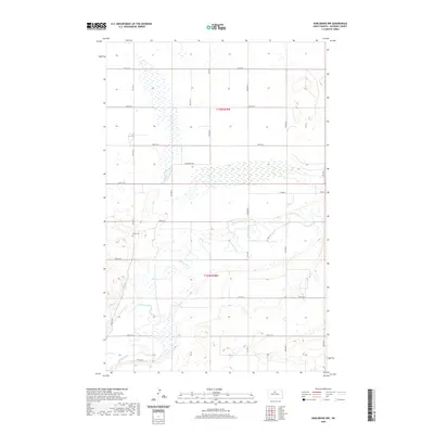
2020 Map of Karlsruhe NW
USGS Topo · Published 2020About this map
The Souris River meanders through the central and southern portions of this McHenry County landscape, defining the local topography with its winding channel and associated wetlands. This 2020 survey illustrates a predominantly rural grid system, with most travel constrained to numbered section roads like 57th St N and 7th Ave N. A quiet historical landmark, Trinity Cem, sits on higher ground west of the river, providing a significant point of interest for genealogists researching families in the vicinity of Township 155 North, Range 78 West. The transition from the flat agricultural plains of the northern sections to the more complex riverine environment highlights the importance of the river for both drainage and transportation, as seen with modern access routes like Souris Dr and River Dr N.
Find a feature on this map
23 named features on this map. Tap any name to fly to it.
Don’t see what you’re looking for? This feature index may not catch every label — zoom into the map to look around manually.
Map Details
Editions of this 2020 Karlsruhe NW Map
This is the sole edition of this map. No revisions or reprints were ever made.
Other maps of this area

1948 · Voltaire
USGS Topo · 1:24,000

1948 · Velva
USGS Topo · 1:62,500

1949 · Simcoe
USGS Topo · 1:24,000

1949 · Voltaire
USGS Topo · 1:24,000

1949 · Riga
USGS Topo · 1:24,000

1949 · Karlsruhe NW
USGS Topo · 1:24,000

1949 · Granville
USGS Topo · 1:24,000

1949 · Denbigh
USGS Topo · 1:24,000

1950 · Karlsruhe NE
USGS Topo · 1:24,000

1950 · Denbigh
USGS Topo · 1:24,000