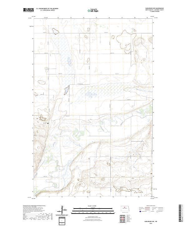
2024 Map of Karlsruhe NW
USGS Topo · Published 2024About this map
The Souris River meanders through this section of McHenry County, defining a landscape of complex prairie wetlands and riparian corridors. This modern survey illustrates the preservation of local habitats within the McHenry County Waterfowl Production Area, a significant conservation tract situated north of the river's main channel. The terrain is characterized by the distinctive pockmarked topography of the Prairie Pothole Region, where numerous small water bodies are scattered across the township lines of t155n r78w and t154n r78w. Cultural landmarks are sparse in this rural area, centered primarily around the Trinity Cem located west of the river. A structured grid of gravel roads, including 57th St N and 7th Ave N, provides access to the agricultural lands that border the river valley.
Find a feature on this map
23 named features on this map. Tap any name to fly to it.
Don’t see what you’re looking for? This feature index may not catch every label — zoom into the map to look around manually.
Map Details
Editions of this 2024 Karlsruhe NW Map
This is the sole edition of this map. No revisions or reprints were ever made.
Other maps of this area

1948 · Voltaire
USGS Topo · 1:24,000

1948 · Velva
USGS Topo · 1:62,500

1949 · Simcoe
USGS Topo · 1:24,000

1949 · Voltaire
USGS Topo · 1:24,000

1949 · Riga
USGS Topo · 1:24,000

1949 · Karlsruhe NW
USGS Topo · 1:24,000

1949 · Granville
USGS Topo · 1:24,000

1949 · Denbigh
USGS Topo · 1:24,000

1950 · Karlsruhe NE
USGS Topo · 1:24,000

1950 · Denbigh
USGS Topo · 1:24,000