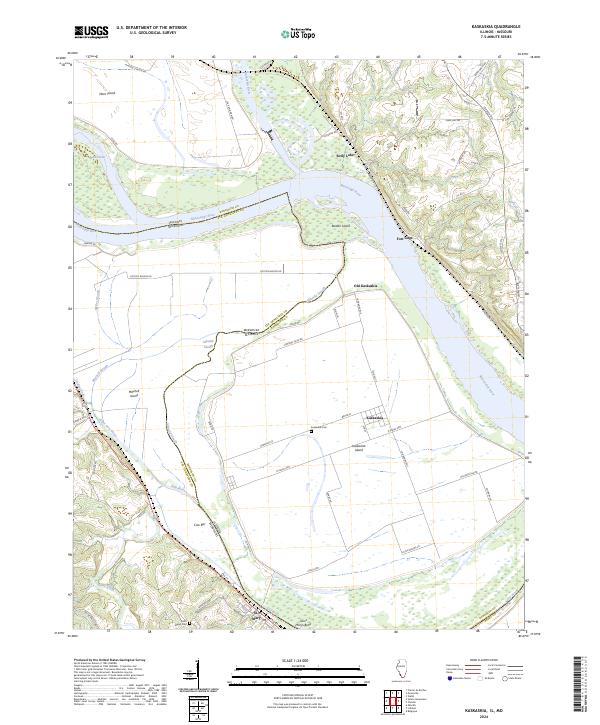
2024 Map of Kaskaskia
USGS Topo · Published 2024About this map
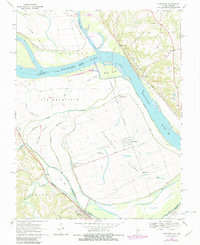
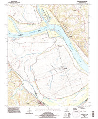
Kaskaskia Island dominates this landscape, a unique piece of Illinois territory now located west of the main channel of the Mississippi River. The map highlights the shifting hydrography of the region, where the Old River and various sloughs like Idlewild Slough and Mitchell Slough trace former paths of the water. This 2024 survey documents the enduring presence of Kaskaskia and Old Kaskaskia, settlements with deep roots in early American history, alongside the Kaskaskia Cem.
Find a feature on this map
69 named features on this map. Tap any name to fly to it.
Don’t see what you’re looking for? This feature index may not catch every label — zoom into the map to look around manually.
Map Details
Editions of this 2024 Kaskaskia Map
This is the sole edition of this map. No revisions or reprints were ever made.
Historical Maps of Fort Gage Through Time
3 maps found