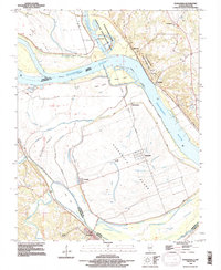
1993 Map of Kaskaskia
USGS Topo · Published 1996About this map
Kaskaskia Island sits uniquely within a bend of the Mississippi River, showcasing a landscape deeply shaped by the shifting course of the great river along the Illinois-Missouri state line. This area is home to the historic settlement of Kaskaskia, alongside the site of Old Kaskaskia, illustrating the movement of community centers in response to river dynamics. The northern bluffs are anchored by Fort Kaskaskia State Historic Site and the landmark Fort Gage, which overlook the expansive bottomlands. The map reveals an intricate network of waterways including McKey Slough and Idlewild Slough, winding between various landmasses like Beaver Island and Roth Island. For genealogists, the inclusion of the Kaskaskia Cemetery and St Mary Cemetery near the settlement of St Mary provides essential location data for tracing families in this riverfront region.
Find a feature on this map
30 named features on this map. Tap any name to fly to it.
Don’t see what you’re looking for? This feature index may not catch every label — zoom into the map to look around manually.
Map Details
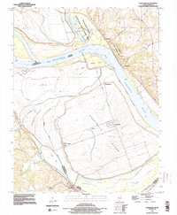
Editions of this 1993 Kaskaskia Map
2 editions found
Other maps of this area

1907 · Weingarten
USGS Topo · 1:62,500

1909 · Weingarten
USGS Topo · 1:62,500

1912 · Baldwin
USGS Topo · 1:62,500

1914 · Baldwin
USGS Topo · 1:62,500

1915 · Renault
USGS Topo · 1:62,500

1915 · Chester
USGS Topo · 1:62,500

1940 · Renault
USGS Topo · 1:62,500

1942 · Baldwin
USGS Topo · 1:62,500

1947 · Chester
USGS Topo · 1:62,500

1949 · Saint Louis
USGS Topo · 1:250,000