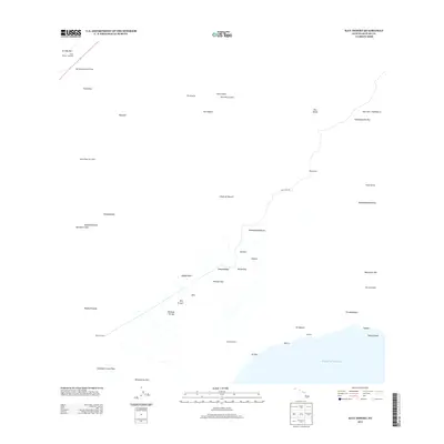
2013 Map of Kau Desert
USGS Topo · Published 2013About this map
Ka'ū Desert dominates this volcanic landscape on the Island of Hawai'i, where centuries of activity are etched into the terrain. The map traces distinct geological events such as the Ke'āmuku Lava Flow and the Lava Flow of 1920, alongside numerous craters and kīpuka including Kīpuka Pepeiao. Sparse infrastructure serves travelers along the Hilina Pali Rd and at the Ka'ū Desert Trailhead, leading to remote outposts like Pepelao Cabin and the Ka'aha Shelter near the coast. The sudden drop-off of the Hilina Pali and Moolelo Pali escarpments defines the descent toward the Pacific Ocean, where the Halapē Shelter sits near the water. This 2013 survey provides a clear view of the shifting volcanic features and hiking routes through one of the island's most dynamic environments.
Find a feature on this map
46 named features on this map. Tap any name to fly to it.
Don’t see what you’re looking for? This feature index may not catch every label — zoom into the map to look around manually.
Map Details
Editions of this 2013 Kau Desert Map
This is the sole edition of this map. No revisions or reprints were ever made.
Other maps of this area

1921 · Kilauea
USGS Topo · 1:62,500

1922 · Puna
USGS Topo · 1:62,500

1923 · Pahala
USGS Topo · 1:62,500

1924 · Kilauea
USGS Topo · 1:62,500

1924 · Puna
USGS Topo · 1:62,500

1954 · Hawaii South
USGS Topo · 1:250,000

1959 · Hawaii South
USGS Topo · 1:250,000

1961 · Hawaii South
USGS Topo · 1:250,000

1962 · Hawaii South
USGS Topo · 1:250,000
1963 · Volcano
USGS Topo · 1:24,000