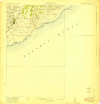
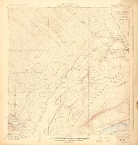
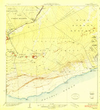
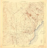
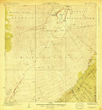
1923 Map of Pahala
USGS Topo · Published 1923About this map
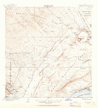
Pahala serves as the central hub of this coastal and volcanic landscape in the early 1920s, surrounded by a cluster of labor settlements including Paho Camp, Keaiwa Camp, and Whitney Camp. These camps, along with Meyer Camp, reflect the organized industrial and agricultural workforce patterns of the Kau District during the Territorial period. The terrain is dramatically defined by active geology, featuring the Great Crack and extensive Lava Flows that descend toward the Pacific Ocean.
Find a feature on this map
45 named features on this map. Tap any name to fly to it.
Don’t see what you’re looking for? This feature index may not catch every label — zoom into the map to look around manually.
Map Details
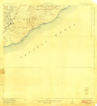
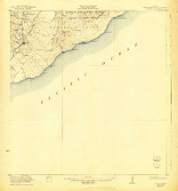
Editions of this 1923 Pahala Map
3 editions found
Other maps of this area
1921 · Kilauea
USGS Topo · 1:62,500

1922 · Puna
USGS Topo · 1:62,500
1924 · Kilauea
USGS Topo · 1:62,500
1924 · Puna
USGS Topo · 1:62,500
1924 · Honuapo
USGS Topo · 1:62,500
1928 · Mauna Loa
USGS Topo · 1:62,500

1954 · Hawaii South
USGS Topo · 1:250,000

1959 · Hawaii South
USGS Topo · 1:250,000

1961 · Hawaii South
USGS Topo · 1:250,000

1962 · Hawaii South
USGS Topo · 1:250,000