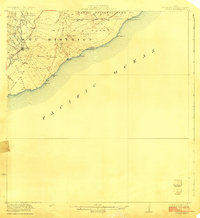
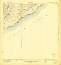
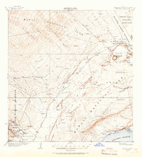
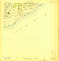
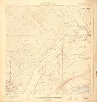
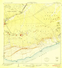
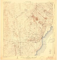
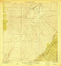
1923 Map of Pahala
USGS Topo · Published 1923About this map
Pahala serves as the primary hub of this coastal survey, where the terrestrial power of the Kau District meets the Pacific Ocean. Early twentieth-century settlement is marked by labor housing and community clusters such as Whitney Camp, Keaiwa Camp, and Lake Camp, which were essential to the region's agricultural and industrial development. The landscape is dominated by volcanic geography, notably the massive Great Crack and the Lava Flow that descends toward the sea near Papalehau Pt. Significant cultural and natural landmarks include the Kuee Ruins near the coast and the high-elevation boundary of Hawaii National Park. Transport and movement in this era were defined by the Volcano Road and the Kukalaula Trail, which connected the shoreline at Mahuka Bay to the interior's Cinder Hills and unique geological features like the Lava Plastered Cones and Hot Cave.
Find a feature on this map
43 named features on this map. Tap any name to fly to it.
Don’t see what you’re looking for? This feature index may not catch every label — zoom into the map to look around manually.
Map Details
Editions of this 1923 Pahala Map
3 editions found
Other maps of this area
1921 · Kilauea
USGS Topo · 1:62,500

1922 · Puna
USGS Topo · 1:62,500
1923 · Pahala
USGS Topo · 1:62,500
1924 · Kilauea
USGS Topo · 1:62,500
1924 · Puna
USGS Topo · 1:62,500
1924 · Honuapo
USGS Topo · 1:62,500
1928 · Mauna Loa
USGS Topo · 1:62,500

1954 · Hawaii South
USGS Topo · 1:250,000

1959 · Hawaii South
USGS Topo · 1:250,000

1961 · Hawaii South
USGS Topo · 1:250,000