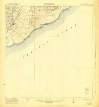
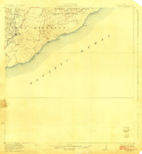
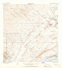
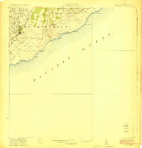
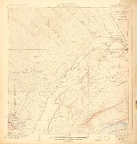
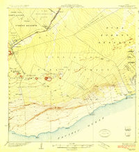
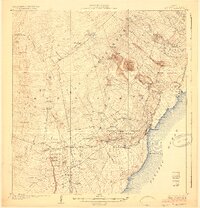
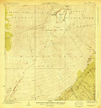
1923 Map of Pahala
USGS Topo · Published 1943About this map
Pahala serves as the primary hub of this coastal territory, which was surveyed between 1920 and 1921. The landscape is heavily defined by its volcanic activity, notably the massive Lava Flow regions and the geologic curiosity known as the Great Crack. Coastal features like Waiwelawela Pt and Nahuku Bay meet a complex terrain of gulches, including Kauhuula Gulch and Hionamoa Gulch, illustrating the erosive power of water on volcanic soil.
Find a feature on this map
48 named features on this map. Tap any name to fly to it.
Don’t see what you’re looking for? This feature index may not catch every label — zoom into the map to look around manually.
Map Details
Editions of this 1923 Pahala Map
3 editions found
Other maps of this area
1921 · Kilauea
USGS Topo · 1:62,500

1922 · Puna
USGS Topo · 1:62,500
1923 · Pahala
USGS Topo · 1:62,500
1924 · Kilauea
USGS Topo · 1:62,500
1924 · Puna
USGS Topo · 1:62,500
1924 · Honuapo
USGS Topo · 1:62,500
1928 · Mauna Loa
USGS Topo · 1:62,500

1954 · Hawaii South
USGS Topo · 1:250,000

1959 · Hawaii South
USGS Topo · 1:250,000

1961 · Hawaii South
USGS Topo · 1:250,000