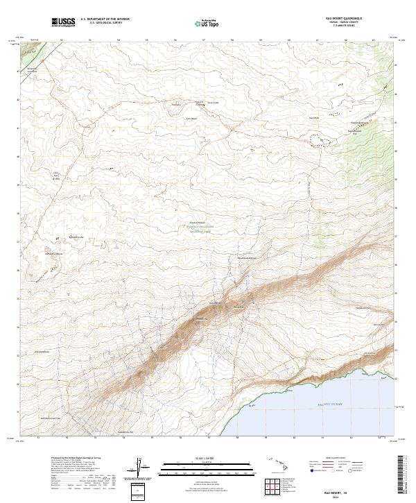
2024 Map of Kau Desert
USGS Topo · Published 2024About this map
Island of Hawai‘i Hawai‘i Volcanoes National Park dominates this landscape, where the volcanic processes of the Big Island meet the edge of the Pacific Ocean. This survey details the stark geomorphology of the Ka‘ũ Desert, characterized by extensive flows like the Lava Flow of 1920 and the Ke‘āmoku Lava Flow. The area is defined by a series of dramatic fault scarps or pali, including Hilina Pali, Moolelo Pali, and Kũkalau‘ula Pali, which drop toward the southern coastline.
Find a feature on this map
45 named features on this map. Tap any name to fly to it.
Don’t see what you’re looking for? This feature index may not catch every label — zoom into the map to look around manually.
Map Details
Editions of this 2024 Kau Desert Map
This is the sole edition of this map. No revisions or reprints were ever made.
Other maps of this area

1921 · Kilauea
USGS Topo · 1:62,500

1922 · Puna
USGS Topo · 1:62,500

1923 · Pahala
USGS Topo · 1:62,500

1924 · Kilauea
USGS Topo · 1:62,500

1924 · Puna
USGS Topo · 1:62,500

1954 · Hawaii South
USGS Topo · 1:250,000

1959 · Hawaii South
USGS Topo · 1:250,000

1961 · Hawaii South
USGS Topo · 1:250,000

1962 · Hawaii South
USGS Topo · 1:250,000
1963 · Volcano
USGS Topo · 1:24,000