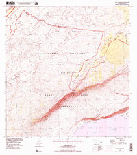
1995 Map of Kau Desert
USGS Topo · Published 1999About this map
Ka'u Desert and the volcanic coastal reaches of Hawaii Volcanoes National Park define this mid-1990s landscape. This survey documents the complex geology of recent history, specifically labeling the Lava Flow of 1920, Lava Flow of 1974, and Lava Flow of 1971. The terrain is characterized by massive volcanic features like Maunaiki and Cone Crater, alongside the sharp descent of Hilina Pali toward the Pacific Ocean. Rare human outposts appear as backcountry waypoints, including Kipukanene and Pepeiao Cabin, while the historic Footprints site near the Ke'amoku Lava Flow marks a significant cultural landmark. Trails like the Ka'u Tr and Puna Ka'u Tr provide the primary means of navigating these expansive wilderness zones, including the Hilina Wilderness and Kipuka Nene Wilderness.
Find a feature on this map
43 named features on this map. Tap any name to fly to it.
Don’t see what you’re looking for? This feature index may not catch every label — zoom into the map to look around manually.
Map Details
Editions of this 1995 Kau Desert Map
This is the sole edition of this map. No revisions or reprints were ever made.
Other maps of this area

1921 · Kilauea
USGS Topo · 1:62,500

1922 · Puna
USGS Topo · 1:62,500

1923 · Pahala
USGS Topo · 1:62,500

1924 · Kilauea
USGS Topo · 1:62,500

1924 · Puna
USGS Topo · 1:62,500

1954 · Hawaii South
USGS Topo · 1:250,000

1959 · Hawaii South
USGS Topo · 1:250,000

1961 · Hawaii South
USGS Topo · 1:250,000

1962 · Hawaii South
USGS Topo · 1:250,000
1963 · Volcano
USGS Topo · 1:24,000