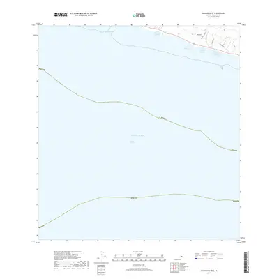
2017 Map of Kaunakakai OE S
USGS Topo · Published 2017About this map
Ancient Hawaiian aquaculture remains a defining element of the south shore of Moloka'i, where several traditional stone-walled fishponds are clearly delineated along the shallow coastline. These features, including Kaloko'eli Fishpond, Ali'i Fishpond, Kaoaini Fishpond, and Kānoa Fishpond, represent a sophisticated system of maritime resource management that persists into the modern era. The landscape transitions from the protected waters of Kaunakakai Harbor across the deep Kalohi Channel toward the open Pacific Ocean. On land, the terrain is marked by steep incisions like 'Onini Gulch, while local transit is facilitated by routes such as Makanui Rd and Uluanui Rd, which provide access to the coastal settlements and the 450 corridor.
Find a feature on this map
15 named features on this map. Tap any name to fly to it.
Don’t see what you’re looking for? This feature index may not catch every label — zoom into the map to look around manually.
Map Details
Editions of this 2017 Kaunakakai OE S Map
This is the sole edition of this map. No revisions or reprints were ever made.
Other maps of this area

1923 · Island of Lanai
USGS Topo · 1:31,680

1925 · Island of Lanai
USGS Topo · 1:62,500

1952 · Kamalo
USGS Topo · 1:24,000

1952 · Kaunakakai
USGS Topo · 1:24,000

1954 · Maui
USGS Topo · 1:250,000

1966 · Maui
USGS Topo · 1:250,000

1967 · Kaunakakai
USGS Topo · 1:24,000
1968 · Kamalo
USGS Topo · 1:24,000

1974 · Maui
USGS Topo · 1:250,000
1983 · Molokai East
USGS Topo · 1:25,000