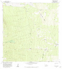
1982 Map of Kaunene
USGS Topo · Published 1984About this map
High-elevation ranching and forest lands on the island of Hawaii define this landscape as it appeared in the early 1980s. The area is marked by a network of 4wd trails that navigate the steep slopes of the Honalina Forest Reserve. Local infrastructure is geared toward water management and cattle operations, evidenced by several scattered Water Tanks and the presence of Gaspars Dairy near the northern boundary. Several small outpost settlements or points of interest are documented across the terrain, including Hapuu Camp and Big Hill Camp.
Find a feature on this map
31 named features on this map. Tap any name to fly to it.
Don’t see what you’re looking for? This feature index may not catch every label — zoom into the map to look around manually.
Map Details
Editions of this 1982 Kaunene Map
2 editions found
Other maps of this area

1927 · Kaohe
USGS Topo · 1:62,500

1928 · Kailua
USGS Topo · 1:62,500

1928 · Mauna Loa
USGS Topo · 1:62,500

1930 · Kaohe
USGS Topo · 1:62,500

1954 · Hawaii South
USGS Topo · 1:250,000

1954 · Hawaii North
USGS Topo · 1:250,000

1956 · Puu O Uo
USGS Topo · 1:24,000

1959 · Hawaii South
USGS Topo · 1:250,000

1959 · Hawaii North
USGS Topo · 1:250,000

1959 · Honaunau
USGS Topo · 1:24,000