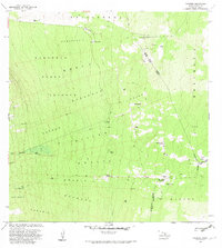
1982 Map of Kaunene
USGS Topo · Published 1982About this map
The Honaunau Forest Reserve dominates this high-altitude landscape on the western slopes of Hawaii, where the terrain is marked by intricate land divisions known as ahupua'a. These long, narrow tracts, such as Kealakekua 2, Keokea, and Waiea, reflect traditional Hawaiian resource management stretching from the mountains toward the sea. The 1980s landscape is primarily defined by ranching and agricultural infrastructure rather than dense settlement. Scattered outposts like Gaspars Dairy, Hapuu Camp, and Big Hill Camp are connected by a network of 4WD trails, illustrating the rugged nature of the South Kona and North Kona districts. Water management is critical at these elevations, evidenced by the numerous Water Tanks and the Komakawai Waterholes near the boundary of the Kau District. Prominent volcanic features like Puu Lehua and Puu Kinikini provide natural landmarks for navigating this upland environment.
Find a feature on this map
41 named features on this map. Tap any name to fly to it.
Don’t see what you’re looking for? This feature index may not catch every label — zoom into the map to look around manually.
Map Details
Editions of this 1982 Kaunene Map
2 editions found
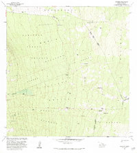
Other maps of this area

1927 · Kaohe
USGS Topo · 1:62,500

1928 · Kailua
USGS Topo · 1:62,500

1928 · Mauna Loa
USGS Topo · 1:62,500

1930 · Kaohe
USGS Topo · 1:62,500

1954 · Hawaii South
USGS Topo · 1:250,000

1954 · Hawaii North
USGS Topo · 1:250,000

1956 · Puu O Uo
USGS Topo · 1:24,000

1959 · Hawaii South
USGS Topo · 1:250,000

1959 · Hawaii North
USGS Topo · 1:250,000

1959 · Honaunau
USGS Topo · 1:24,000