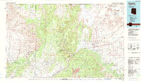
1984 Map of Kayenta
USGS Topo · Published 1984About this map
Navajo National Monument and the high desert expanse of Skeleton Mesa define the central portion of this 1984 survey. The settlement of Kayenta serves as a hub for the region, positioned near the intersection of Us 163 and Us 160. The map captures the complex drainage systems of the Shonto Plateau, where Shonto Wash and Begashibito Wash carve through the sandstone. To the north, the iconic spires of Monument Valley cross the state line into Utah, while Black Mesa dominates the southern reaches with the Yellow Water Mine providing evidence of local resource extraction. The presence of the Kayenta Landing Field and several radio towers highlights the modern infrastructure supporting this remote area of the Navajo Indian Reservation.
Find a feature on this map
68 named features on this map. Tap any name to fly to it.
Don’t see what you’re looking for? This feature index may not catch every label — zoom into the map to look around manually.
Map Details
Editions of this 1984 Kayenta Map
This is the sole edition of this map. No revisions or reprints were ever made.
Other maps of this area

1883 · Marsh Pass
USGS Topo · 1:250,000

1886 · Escalante
USGS Topo · 1:250,000

1886 · Henry Mountains
USGS Topo · 1:250,000

1886 · Abajo
USGS Topo · 1:250,000

1886 · Echo Cliffs
USGS Topo · 1:250,000

1891 · Echo Cliffs
USGS Topo · 1:250,000

1892 · Marsh Pass
USGS Topo · 1:250,000

1892 · Abajo
USGS Topo · 1:250,000

1892 · Henry Mountains
USGS Topo · 1:250,000

1892 · Canyon De Chelly
USGS Topo · 1:250,000