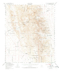
1948 Map of Kaylor Mountain
USGS Topo · Published 1973About this map
Alamogordo Bombing Range and the White Sands Proving Ground dominate this 1948 survey of the southern San Andres Mountains, reflecting the post-war conversion of New Mexico's high desert into a military testing corridor. Despite the massive scale of these federal reservations, the map preserves the names of the remote cattle operations and family holdings that existed before the land was withdrawn from public use, including the Anderegg Ranch Headquarters and Ritch Ranch.
Find a feature on this map
56 named features on this map. Tap any name to fly to it.
Don’t see what you’re looking for? This feature index may not catch every label — zoom into the map to look around manually.
Map Details
Editions of this 1948 Kaylor Mountain Map
3 editions found

Other maps of this area

1916 · Tonuco
USGS Topo · 1:125,000

1916 · Salinas Peak
USGS Topo · 1:125,000

1916 · Tularosa
USGS Topo · 1:125,000

1916 · Point Of Sands
USGS Topo · 1:125,000

1932 · Tonuco
USGS Topo · 1:125,000

1947 · Point Of Sands 2
USGS Topo · 1:62,500

1947 · Lake Lucero
USGS Topo · 1:62,500

1948 · Sowell
USGS Topo · 1:62,500

1948 · Chicken Well
USGS Topo · 1:62,500

1948 · Bear Peak
USGS Topo · 1:62,500