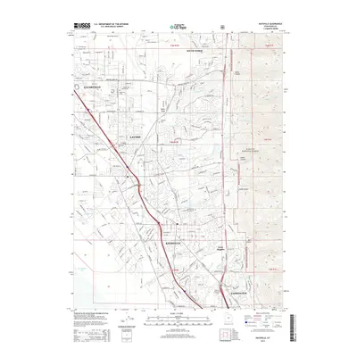
2014 Map of Kaysville
USGS Topo · Published 2014About this map
Kaysville, Layton, and Clearfield dominate the suburban corridor between the rising slopes of the Wasatch National Forest and the marshy edges of Farmington Bay. This 2014 survey documents a landscape of dense residential growth and institutional landmarks, including the southern reaches of Hill Air Force Base and the Utah State Experiment Farm near Farmington. The mapping of canyons like Adams Canyon and Webb Canyon alongside established sites such as the Kaysville and Layton Memorial Cem provides a detailed look at how the region's geography dictates its development patterns. Education and commerce are anchored by facilities like Eagle Gate Coll and Vista Coll, reflecting the area's mid-century transition from agricultural roots to a modern metropolitan center while maintaining proximity to the high-elevation terrain of Oyster Ridge.
Find a feature on this map
147 named features on this map. Tap any name to fly to it.
Don’t see what you’re looking for? This feature index may not catch every label — zoom into the map to look around manually.
Map Details
Editions of this 2014 Kaysville Map
This is the sole edition of this map. No revisions or reprints were ever made.
Other maps of this area

1885 · Salt Lake
USGS Topo · 1:250,000

1885 · Tooele Valley
USGS Topo · 1:250,000

1925 · Ft. Douglas
USGS Topo · 1:125,000

1928 · Ft. Douglas
USGS Topo · 1:125,000

1952 · Saltair NE
USGS Topo · 1:24,000

1952 · Farmington
USGS Topo · 1:24,000

1952 · Bountiful Peak
USGS Topo · 1:24,000

1953 · Tooele
USGS Topo · 1:250,000

1954 · Salt Lake City
USGS Topo · 1:250,000

1954 · Ogden
USGS Topo · 1:250,000