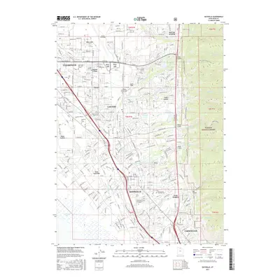
2017 Map of Kaysville
USGS Topo · Published 2017About this map
The corridor of Davis County is defined by the steep transition from the Wasatch National Forest down to the eastern shores of Farmington Bay. This area, heavily influenced by the presence of Hill AFB, shows a dense network of suburban and military development centered on Kaysville and Layton. Historical footprints are visible at the Hill Cem and Kaysville City Cem, while the landscape is punctuated by water management features like Adams Reservoir and Hobbs Reservoir. To the west, the settlements of West Kaysville and West Layton stretch toward the wetlands, while to the east, the Bonneville Shoreline N trail follows the ancient bench of Lake Bonneville. This map captures a modern view of the region's educational and military infrastructure, including several university campuses and the expansive airfield of Hill AFB.
Find a feature on this map
51 named features on this map. Tap any name to fly to it.
Don’t see what you’re looking for? This feature index may not catch every label — zoom into the map to look around manually.
Map Details
Editions of this 2017 Kaysville Map
This is the sole edition of this map. No revisions or reprints were ever made.
Other maps of this area

1885 · Salt Lake
USGS Topo · 1:250,000

1885 · Tooele Valley
USGS Topo · 1:250,000

1925 · Ft. Douglas
USGS Topo · 1:125,000

1928 · Ft. Douglas
USGS Topo · 1:125,000

1952 · Saltair NE
USGS Topo · 1:24,000

1952 · Farmington
USGS Topo · 1:24,000

1952 · Bountiful Peak
USGS Topo · 1:24,000

1953 · Tooele
USGS Topo · 1:250,000

1954 · Salt Lake City
USGS Topo · 1:250,000

1954 · Ogden
USGS Topo · 1:250,000