
1959 Map of Keahole Point
USGS Topo · Published 1960About this map
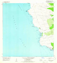
The Lava Flow of 1801 dominates the northern landscape of this North Kona coastline, sweeping down from the uplands toward Unualoha Pt. This 1959 field check reveals a coastal environment defined by ancient cultural sites and the early infrastructure of modern Hawaii. Numerous sacred sites are recorded along the rocky shore, including Ahuena Heiau at Kailua Bay, and the Hale o Mano Heiau and Hale o Lono Heiau near Honokohau Bay. Evidence of early settlement patterns is visible in the Kalaoa Ooma Homesteads and Kealakehe Homesteads, which are connected to the shoreline by a network of paths such as the Old Mamalahoa Trail and various jeep tracks. The presence of the Kaloko Fishpond and scattered Petroglyphs points to a long history of land use preceding the mid-century development of the Kona Airport on the Keahuolu flats.
Find a feature on this map
58 named features on this map. Tap any name to fly to it.
Don’t see what you’re looking for? This feature index may not catch every label — zoom into the map to look around manually.
Map Details
Editions of this 1959 Keahole Point Map
2 editions found
Other maps of this area

1928 · Puako
USGS Topo · 1:62,500

1928 · Kailua
USGS Topo · 1:62,500

1954 · Hawaii North
USGS Topo · 1:250,000

1959 · Hawaii North
USGS Topo · 1:250,000

1959 · Kiholo
USGS Topo · 1:24,000

1959 · Makalawena
USGS Topo · 1:24,000

1959 · Kailua
USGS Topo · 1:24,000
1960 · Kealakekua
USGS Topo · 1:24,000

1961 · Hawaii North
USGS Topo · 1:250,000

1975 · Hawaii
USGS Topo · 1:250,000