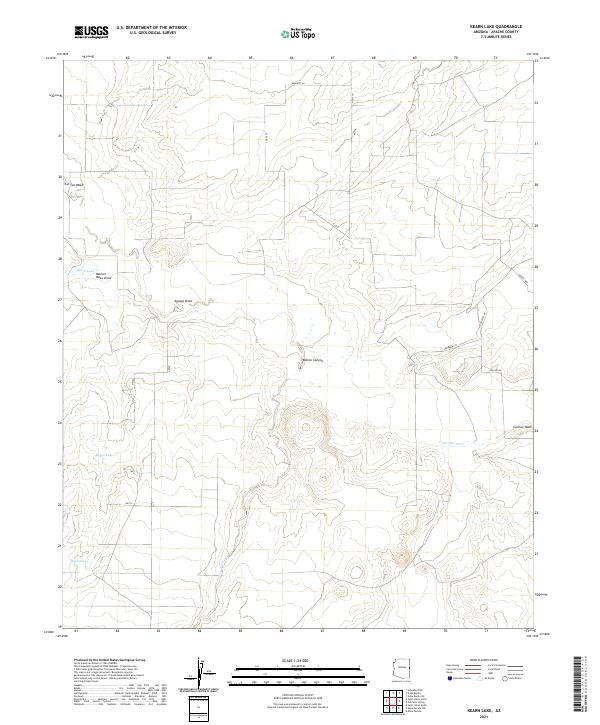
2021 Map of Kearn Lake
USGS Topo · Published 2021About this map
Kearn Lake sits at the center of a drainage network characterized by seasonal washes and broad canyons in eastern Arizona. This modern survey illustrates a landscape where cattle ranching and modern homesteading meet ancient geographic features like Blanco Canyon and the winding Carrizo Wash. The map records a sparse network of modern named routes including Anasazi Rd and Dobie's Way, which overlay the long-established land divisions of T14N R29E and T13N R30E. For the researcher, the presence of isolated water bodies like Boney Lake and Big Lake provides critical landmarks in an arid environment defined by topographic features such as Marion Haws Draw and Aguaje Draw.
Find a feature on this map
17 named features on this map. Tap any name to fly to it.
Don’t see what you’re looking for? This feature index may not catch every label — zoom into the map to look around manually.
Map Details
Editions of this 2021 Kearn Lake Map
This is the sole edition of this map. No revisions or reprints were ever made.
Other maps of this area

1886 · St Johns
USGS Topo · 1:250,000

1892 · St Johns
USGS Topo · 1:250,000

1954 · Saint Johns
USGS Topo · 1:250,000

1957 · Saint Johns
USGS Topo · 1:250,000

1958 · Saint Johns
USGS Topo · 1:250,000

1962 · Saint Johns
USGS Topo · 1:250,000

1971 · Mesa Parada NW
USGS Topo · 1:24,000

1971 · Mesa Parada
USGS Topo · 1:24,000
1971 · St. Johns South
USGS Topo · 1:24,000
1974 · St. Johns North
USGS Topo · 1:24,000