
1971 Map of Mesa Parada
USGS Topo · Published 1973About this map
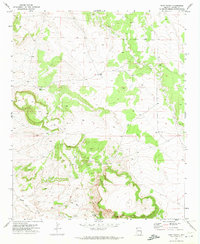
The borderlands between Apache County and Catron County are defined by the high desert terrain surrounding Mesa Parada. This early 1970s survey illustrates a landscape managed for water, marked by a network of isolated wells, springs, and catchment tanks essential for ranching and survival in the arid West. The topography drops sharply into Amarilla Canyon and Cottonwood Wash, where seasonal drainage patterns shape the earth. Remote infrastructure is evident in named water sources such as Little Electric Well and Gallegos Springs, reflecting the local family names and small-scale engineering of the era. This map is a clear record of the high-plateau geography that straddles the Arizona-New Mexico state line before modern development altered these traditional grazing lands.
Find a feature on this map
17 named features on this map. Tap any name to fly to it.
Don’t see what you’re looking for? This feature index may not catch every label — zoom into the map to look around manually.
Map Details
Editions of this 1971 Mesa Parada Map
This is the sole edition of this map. No revisions or reprints were ever made.
Other maps of this area

1886 · St Johns
USGS Topo · 1:250,000

1892 · St Johns
USGS Topo · 1:250,000

1954 · Saint Johns
USGS Topo · 1:250,000

1957 · Saint Johns
USGS Topo · 1:250,000

1958 · Saint Johns
USGS Topo · 1:250,000

1962 · Saint Johns
USGS Topo · 1:250,000

1971 · Mesa Parada NW
USGS Topo · 1:24,000
1971 · Voigt Ranch
USGS Topo · 1:24,000
1971 · The Rincon
USGS Topo · 1:24,000

1972 · Twentytwo Spring
USGS Topo · 1:24,000