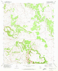
1971 Map of Voigt Ranch
USGS Topo · Published 1973About this map
Voigt Ranch and the remote outpost of The Aztec define this corner of Apache County during the early 1970s. The landscape is characterized by its high-country ranching infrastructure, where water sources like Stamps Spring and various water tanks were critical to sustaining livestock across the arid terrain. A network of primitive transit routes, including a prominent Jeep Trail, connects these working sites through the high plateaus.
Find a feature on this map
11 named features on this map. Tap any name to fly to it.
Don’t see what you’re looking for? This feature index may not catch every label — zoom into the map to look around manually.
Map Details
Editions of this 1971 Voigt Ranch Map
2 editions found
Other maps of this area

1886 · St Johns
USGS Topo · 1:250,000

1892 · St Johns
USGS Topo · 1:250,000

1954 · Saint Johns
USGS Topo · 1:250,000

1957 · Saint Johns
USGS Topo · 1:250,000

1958 · Saint Johns
USGS Topo · 1:250,000

1962 · Saint Johns
USGS Topo · 1:250,000
1968 · Nelson Reservoir NE
USGS Topo · 1:24,000

1969 · Coyote Hills
USGS Topo · 1:24,000
1969 · Springerville
USGS Topo · 1:24,000

1971 · Mesa Parada NW
USGS Topo · 1:24,000