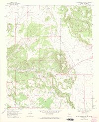
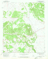
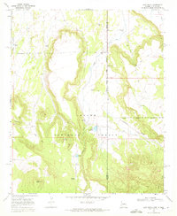
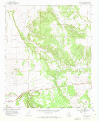
1968 Map of Nelson Reservoir NE
USGS Topo · Published 1972About this map
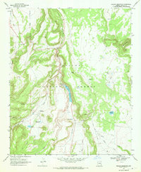
Coyote Creek meanders through this high-altitude landscape along the border of Apache and Catron Counties during the late 1960s. The area is defined by its remote ranching and industrial utility, evidenced by the presence of a Corral in the north and the Becket Res Dam at the southern edge. The map captures a moment when the terrain was largely accessible via a network of Jeep Trails, supporting localized resource extraction. This is visible in the clusters of Gravel Pits and Borrow Pits that dot the topography, likely supporting regional road construction or maintenance. Strategically placed Water Tanks reflect the essential infrastructure required for livestock management in this arid environment where Arizona and New Mexico meet.
Find a feature on this map
12 named features on this map. Tap any name to fly to it.
Don’t see what you’re looking for? This feature index may not catch every label — zoom into the map to look around manually.
Map Details
Editions of this 1968 Nelson Reservoir NE Map
2 editions found
Other maps of this area

1886 · St Johns
USGS Topo · 1:250,000

1892 · St Johns
USGS Topo · 1:250,000

1954 · Saint Johns
USGS Topo · 1:250,000

1957 · Saint Johns
USGS Topo · 1:250,000

1958 · Saint Johns
USGS Topo · 1:250,000

1962 · Saint Johns
USGS Topo · 1:250,000
1968 · Loco Knoll
USGS Topo · 1:24,000
1969 · Coyote Hills
USGS Topo · 1:24,000
1969 · Nelson Reservoir
USGS Topo · 1:24,000
1971 · Voigt Ranch
USGS Topo · 1:24,000