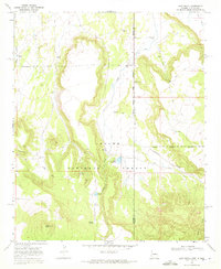
1968 Map of Loco Knoll
USGS Topo · Published 1972About this map
The high country of the Apache National Forest straddles the high-desert borderlands of Arizona and New Mexico in this late-1960s survey. The landscape is defined by the sharp elevations of Loco Knoll and the Loco Knolls, providing a rugged backdrop for the ranching and resource activities of the era. The presence of the H-V Ranch, complete with its H-V Reservoir and several Corral sites, suggests a landscape managed for cattle and land use. Natural water sources like Thomas Spring, Chase Spring, and Pratt Lake are vital markers in this arid environment, interconnected by a network of drainage features including Coyote Creek and Canoas Creek. Human activity is further evidenced by a Cinder Pit and several Water Tanks positioned near the established Trail and Jeep Trail systems, which trace the undulating terrain and historical boundary lines between Apache and Catron counties.
Find a feature on this map
20 named features on this map. Tap any name to fly to it.
Don’t see what you’re looking for? This feature index may not catch every label — zoom into the map to look around manually.
Map Details
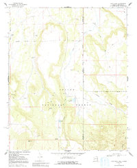
Editions of this 1968 Loco Knoll Map
2 editions found
Other maps of this area

1886 · St Johns
USGS Topo · 1:250,000

1892 · St Johns
USGS Topo · 1:250,000

1915 · Reserve
USGS Topo · 1:125,000

1918 · Reserve
USGS Topo · 1:125,000

1922 · Nutrioso
USGS Topo · 1:125,000

1954 · Clifton
USGS Topo · 1:250,000

1954 · Saint Johns
USGS Topo · 1:250,000

1957 · Clifton
USGS Topo · 1:250,000

1957 · Saint Johns
USGS Topo · 1:250,000

1958 · Clifton
USGS Topo · 1:250,000