
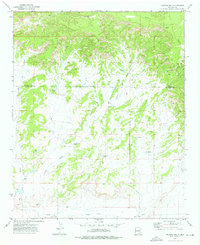
1972 Map of Twentytwo Spring
USGS Topo · Published 1976About this map
Twentytwo Spring and the associated Twentytwo Draw anchor this high-altitude landscape along the border of Valencia and Catron counties. This 1970s-era topographical study reveals a remote cattle-grazing environment where survival depends on a series of man-made and natural water improvements. The map documents the specific locations of several catchment points, including Horse Canyon Tank, Big Sand Tank, and Indian Tank, which provide a clear picture of how the rangeland was managed for livestock during this period.
Find a feature on this map
17 named features on this map. Tap any name to fly to it.
Don’t see what you’re looking for? This feature index may not catch every label — zoom into the map to look around manually.
Map Details
Editions of this 1972 Twentytwo Spring Map
This is the sole edition of this map. No revisions or reprints were ever made.
Other maps of this area

1886 · St Johns
USGS Topo · 1:250,000

1892 · St Johns
USGS Topo · 1:250,000

1954 · Saint Johns
USGS Topo · 1:250,000

1957 · Saint Johns
USGS Topo · 1:250,000

1958 · Saint Johns
USGS Topo · 1:250,000

1962 · Saint Johns
USGS Topo · 1:250,000

1971 · Mesa Parada
USGS Topo · 1:24,000

1972 · Zuni Salt Lake
USGS Topo · 1:24,000

1972 · Cantaralo Spring
USGS Topo · 1:24,000
1972 · Moreno Hill
USGS Topo · 1:24,000