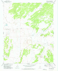
1977 Map of Kearn Lake
USGS Topo · Published 1978About this map
Purcell Well and the surrounding ranching landscape of Apache County define this mid-1970s survey. The terrain is characterized by a complex network of seasonal drainage systems, including the prominent Carrizo Wash and Blanco Canyon, which dictate the placement of human improvements. Water access is the primary driver of development here, as evidenced by numerous scattered water sources such as Kearn Lake, Boney Lake, and Big Lake. The map reveals the infrastructure of the high desert livestock industry, marking remote outposts like Los Pilas Well, Owyhee Well, and Blanco Well. The presence of several Corral sites further underscores the area's agricultural focus, where natural features like Aguaie Draw and Jarvis Wash carve through the land.
Find a feature on this map
17 named features on this map. Tap any name to fly to it.
Don’t see what you’re looking for? This feature index may not catch every label — zoom into the map to look around manually.
Map Details
Editions of this 1977 Kearn Lake Map
This is the sole edition of this map. No revisions or reprints were ever made.
Other maps of this area

1886 · St Johns
USGS Topo · 1:250,000

1892 · St Johns
USGS Topo · 1:250,000

1954 · Saint Johns
USGS Topo · 1:250,000

1957 · Saint Johns
USGS Topo · 1:250,000

1958 · Saint Johns
USGS Topo · 1:250,000

1962 · Saint Johns
USGS Topo · 1:250,000

1971 · Mesa Parada NW
USGS Topo · 1:24,000

1971 · Mesa Parada
USGS Topo · 1:24,000
1971 · St. Johns South
USGS Topo · 1:24,000
1974 · St. Johns North
USGS Topo · 1:24,000