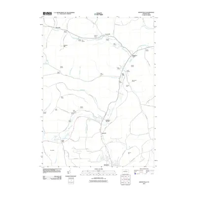
2010 Map of Keeneyville
USGS Topo · Published 2010About this map
Crooked Creek and Marsh Creek define the drainage of this Tioga County landscape, where small hamlets are connected by a network of winding valley roads and ridge trails. The settlement at Middlebury Center serves as a central point between Keeneyville to the north and Wellsboro Junction to the south. The terrain is characterized by dozens of named hollows, such as Sweet Hollow, Catlin Hollow, and Hibard Hollow, reflecting the deeply incised plateau geography typical of the region. Family history researchers may find significant detail in the locations of the Middlebury Union Cemetery and Niles Valley Cemetery, or the descriptive Schoolhouse Hollow and Log Cabin Spring. The map also captures the confluence of several mountain runs, including Horse Thief Run and Baldwin Run, which descend from higher elevations like Oak Ridge and Christian Hill to feed the valley floors.
Find a feature on this map
79 named features on this map. Tap any name to fly to it.
Don’t see what you’re looking for? This feature index may not catch every label — zoom into the map to look around manually.
Map Details
Editions of this 2010 Keeneyville Map
This is the sole edition of this map. No revisions or reprints were ever made.
Other maps of this area

1900 · Tioga
USGS Topo · 1:62,500

1900 · Elkland
USGS Topo · 1:62,500

1902 · Tioga
USGS Topo · 1:62,500

1925 · Blossburg
USGS Topo · 1:62,500

1927 · Blossburg
USGS Topo · 1:62,500

1944 · Blossburg
USGS Topo · 1:62,500

1946 · Tiadaghton
USGS Topo · 1:24,000

1946 · Antrim
USGS Topo · 1:62,500

1946 · Antrim
USGS Topo · 1:24,000

1948 · Antrim
USGS Topo · 1:24,000
Featured Places
- Wellsboro, PA
- Keeneyville, Middlebury Township
- Middlebury Township, PA
- Chatham Township, PA
- Delmar Township, PA