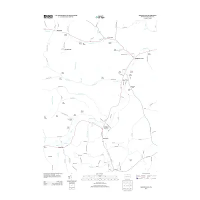
2013 Map of Keeneyville
USGS Topo · Published 2013About this map
Wellsboro Junction sits at a critical topographic and transport node where the waters of Marsh Creek and Baldwin Run converge. The landscape is defined by a dense network of hollows, such as Schoolhouse Hollow and Hibard Hollow, which cut through the high ground of Oak Ridge and Barlow Hill. These landforms dictate the settlement patterns of Tioga County, with villages like Middlebury Center, Keeneyville, and Niles Valley clustered along the major creek valleys. Local history is etched into the terrain via named features like Log Cabin Spring and Oil Well Hollow, hinting at the region's early resource extraction and pioneering homesteads. Small air transport is represented by the Middlebury Airport, while the legacy of 19th-century infrastructure remains visible through the road placements following the winding course of Crooked Creek.
Find a feature on this map
114 named features on this map. Tap any name to fly to it.
Don’t see what you’re looking for? This feature index may not catch every label — zoom into the map to look around manually.
Map Details
Editions of this 2013 Keeneyville Map
This is the sole edition of this map. No revisions or reprints were ever made.
Other maps of this area

1900 · Tioga
USGS Topo · 1:62,500

1900 · Elkland
USGS Topo · 1:62,500

1902 · Tioga
USGS Topo · 1:62,500

1925 · Blossburg
USGS Topo · 1:62,500

1927 · Blossburg
USGS Topo · 1:62,500

1944 · Blossburg
USGS Topo · 1:62,500

1946 · Tiadaghton
USGS Topo · 1:24,000

1946 · Antrim
USGS Topo · 1:62,500

1946 · Antrim
USGS Topo · 1:24,000

1948 · Antrim
USGS Topo · 1:24,000
Featured Places
- Wellsboro, PA
- Keeneyville, Middlebury Township
- Middlebury Township, PA
- Chatham Township, PA
- Delmar Township, PA