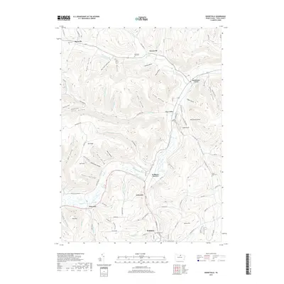
2019 Map of Keeneyville
USGS Topo · Published 2019About this map
Keeneyville and Middlebury Center serve as central points in this Tioga County landscape, where the meandering Crooked Creek carves a path through numerous named hollows. The northern section is defined by a series of dramatic geographic depressions such as Keeney Hollow, Button Hollow, and Roe Hollow, reflecting the intricate drainage patterns of the region. Near the center of the sheet, Niles Valley sits at the confluence of several valleys, including Niles Hollow and Wedge Hollow. To the south, the terrain transitions toward Wellsboro Junction and Stokesdale, where Marsh Creek and Wolf Run meet. Genealogists will find several burial grounds documented, including Middlebury Union Cem and Catlin Hollow Cem. The map provides a detailed look at rural infrastructure, from the Log Cabin Spring to the scattered settlements of Shortsville and Heise Run.
Find a feature on this map
89 named features on this map. Tap any name to fly to it.
Don’t see what you’re looking for? This feature index may not catch every label — zoom into the map to look around manually.
Map Details
Editions of this 2019 Keeneyville Map
This is the sole edition of this map. No revisions or reprints were ever made.
Other maps of this area

1900 · Tioga
USGS Topo · 1:62,500

1900 · Elkland
USGS Topo · 1:62,500

1902 · Tioga
USGS Topo · 1:62,500

1925 · Blossburg
USGS Topo · 1:62,500

1927 · Blossburg
USGS Topo · 1:62,500

1944 · Blossburg
USGS Topo · 1:62,500

1946 · Tiadaghton
USGS Topo · 1:24,000

1946 · Antrim
USGS Topo · 1:62,500

1946 · Antrim
USGS Topo · 1:24,000

1948 · Antrim
USGS Topo · 1:24,000
Featured Places
- Wellsboro, PA
- Keeneyville, Middlebury Township
- Middlebury Township, PA
- Chatham Township, PA
- Delmar Township, PA