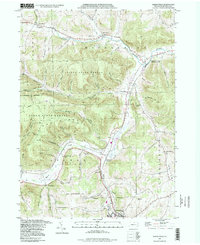
1994 Map of Keeneyville
USGS Topo · Published 1998About this map
Crooked Creek and Marsh Creek define the drainage of this north-central Pennsylvania landscape, where valleys transition from the wilder terrain of the Tioga State Forest to established farming and railroad communities. The northern half of the map centers on the small settlements of Keeneyville, Shortsville, and Middlebury Center, while the southern reaches move toward the borough of Wellsboro. This geography highlights the critical role of creek-side corridors for transportation, following the route of the Roosevelt Highway and rail infrastructure near Wellsboro Junction.
Find a feature on this map
58 named features on this map. Tap any name to fly to it.
Don’t see what you’re looking for? This feature index may not catch every label — zoom into the map to look around manually.
Map Details
Editions of this 1994 Keeneyville Map
This is the sole edition of this map. No revisions or reprints were ever made.
Other maps of this area

1900 · Tioga
USGS Topo · 1:62,500

1900 · Elkland
USGS Topo · 1:62,500

1902 · Tioga
USGS Topo · 1:62,500

1925 · Blossburg
USGS Topo · 1:62,500

1927 · Blossburg
USGS Topo · 1:62,500

1944 · Blossburg
USGS Topo · 1:62,500

1946 · Tiadaghton
USGS Topo · 1:24,000

1946 · Antrim
USGS Topo · 1:62,500

1946 · Antrim
USGS Topo · 1:24,000

1948 · Antrim
USGS Topo · 1:24,000
Featured Places
- Wellsboro, PA
- Stokesdale, Delmar Township
- Keeneyville, Middlebury Township
- Shortsville, Chatham Township
- Middlebury Township, PA