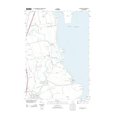
2013 Map of Keeseville
USGS Topo · Published 2013About this map
The dramatic geological formation of Ausable Chasm serves as a centerpiece for this region of Clinton County, where the Ausable River carves through the landscape before reaching Lake Champlain. The village of Keeseville sits at the southwestern edge of the map, nestled within the Adirondack Park Preserve and marked by several local burial grounds including Saint Johns Cem and Evergreen Cem. Along the lakefront, the map details a varied shoreline characterized by Ausable Point and the prominent Valcour Island, which is home to the Valcour Lighthouse Light. The settlement of Port Kent occupies the eastern coast, serving as a historic point of transit on the water. Inland, agricultural operations like Remillard Farm and Clover Mead Farm dot the terrain, while smaller aviation facilities such as Secret Spot Airport indicate more modern land use amidst the traditional orchards and river valleys.
Find a feature on this map
100 named features on this map. Tap any name to fly to it.
Don’t see what you’re looking for? This feature index may not catch every label — zoom into the map to look around manually.
Map Details
Editions of this 2013 Keeseville Map
This is the sole edition of this map. No revisions or reprints were ever made.
Other maps of this area

1894 · Plattsburg
USGS Topo · 1:62,500

1895 · Willsboro
USGS Topo · 1:62,500

1895 · Ausable
USGS Topo · 1:62,500

1903 · Ausable
USGS Topo · 1:62,500

1906 · Plattsburg
USGS Topo · 1:62,500

1913 · Dannemora
USGS Topo · 1:62,500

1939 · Plattsburg
USGS Topo · 1:62,500

1941 · Plattsburg
USGS Topo · 1:62,500

1941 · Willsboro
USGS Topo · 1:62,500

1943 · Willsboro
USGS Topo · 1:62,500