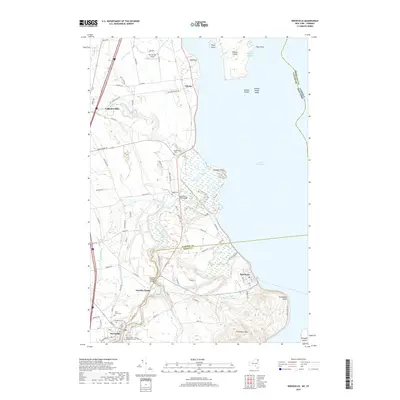
2019 Map of Keeseville
USGS Topo · Published 2019About this map
The village of Keeseville straddles the boundary of Clinton and Essex counties, positioned near the dramatic falls of the Ausable River. This 2019 survey documents the complex water network of the Lake Champlain shoreline, where the river carves through the geological landmark of Ausable Chasm before reaching the delta at Ausable Point. The landscape is a mix of small historic settlements like Laphams Mills and Valcour, and preserved natural areas such as the Wickham Marsh Wildlife Management Area. Genealogists will find several burial sites recorded, including Evergreen Cem and Saint Johns Cem near the village center. To the east, the map details the shoreline geography from Port Kent up to Day Point, including Valcour Island and its protected anchorages at Sloop Bay and Smuggler Harbor, which sit across the state line from Vermont in the waters of Lake Champlain.
Find a feature on this map
95 named features on this map. Tap any name to fly to it.
Don’t see what you’re looking for? This feature index may not catch every label — zoom into the map to look around manually.
Map Details
Editions of this 2019 Keeseville Map
This is the sole edition of this map. No revisions or reprints were ever made.
Other maps of this area

1894 · Plattsburg
USGS Topo · 1:62,500

1895 · Willsboro
USGS Topo · 1:62,500

1895 · Ausable
USGS Topo · 1:62,500

1903 · Ausable
USGS Topo · 1:62,500

1906 · Plattsburg
USGS Topo · 1:62,500

1913 · Dannemora
USGS Topo · 1:62,500

1939 · Plattsburg
USGS Topo · 1:62,500

1941 · Plattsburg
USGS Topo · 1:62,500

1941 · Willsboro
USGS Topo · 1:62,500

1943 · Willsboro
USGS Topo · 1:62,500