Loading...
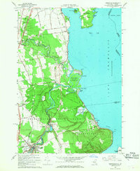
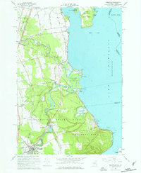
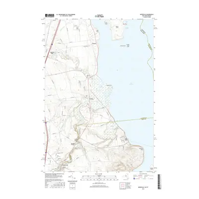
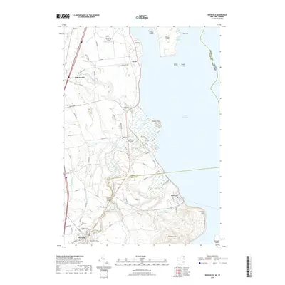
Loading map...1966 Map of Keeseville
USGS Topo · Published 1968About this map
The dramatic gorge of Ausable Chasm defines the interior of this Lake Champlain coastal survey, showing where the river cuts through the landscape toward the Upper Mouth and Lower Mouth. The village of Keeseville anchors the southern end of the sheet, surrounded by several family and parish burial grounds including Evergreen Cem and St Johns Cem. Along the lake, the Delaware and Hudson RR follows the shoreline through Port Kent and north toward Valcour, providing a vital transit link between the Adirondacks and the lakefront.
Find a feature on this map
74 named features on this map. Tap any name to fly to it.
Don’t see what you’re looking for? This feature index may not catch every label — zoom into the map to look around manually.
Map Details
Date Portrayed1966
Date Published1968
PublisherU.S. Geological Survey
Map TypeTopographic
Scale1:24,000
Physical Dimensions22 x 26.9 inches
Editions of this 1966 Keeseville Map
2 editions found
Historical Maps of Plattsburgh Through Time
6 maps found

Featured Locations
Source Details
SourceU.S. Geological Survey
CopyrightPublic Domain