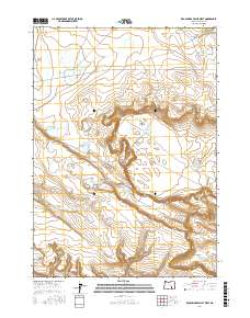
2017 Map of Keg Springs Valley West
USGS Topo · Published 2017About this map
Keg Springs Valley sits at the center of this high-desert landscape in Harney County, characterized by a complex network of seasonal waterholes and reservoirs essential for land management. The geography is defined by expansive flats like Foster Flat and named depressions that collect water, such as Jerrys Lake, Munsey Lake, and the small Tucke Lake in the southern reaches. Human intervention in this arid environment is evident through the naming of the Foster Lake CCC Rd and the CCC Reservoir, indicating the legacy of the Civilian Conservation Corps in developing infrastructure here. Strategic water points like the Keg Springs Rimrock Reservoir and New Hole Reservoir highlight the region's reliance on managed water sources. The terrain transitions into more pronounced relief at Rocky Butte and the steep descent of V Canyon to the southeast.
Find a feature on this map
21 named features on this map. Tap any name to fly to it.
Don’t see what you’re looking for? This feature index may not catch every label — zoom into the map to look around manually.
Map Details
Editions of this 2017 Keg Springs Valley West Map
This is the sole edition of this map. No revisions or reprints were ever made.
Other maps of this area

1955 · Burns
USGS Topo · 1:250,000

1955 · Adel
USGS Topo · 1:250,000

1957 · Adel
USGS Topo · 1:250,000

1958 · Burns
USGS Topo · 1:250,000

1958 · Adel
USGS Topo · 1:250,000

1959 · Burns
USGS Topo · 1:250,000

1962 · Adel
USGS Topo · 1:250,000

1971 · Duhaime Flat East
USGS Topo · 1:24,000

1971 · Clover Swale
USGS Topo · 1:24,000
1971 · Keg Sprs Valley East
USGS Topo · 1:24,000