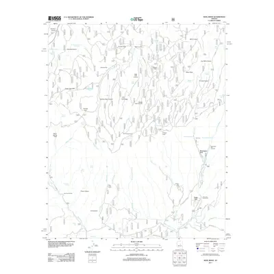
2011 Map of Kehl Ridge
USGS Topo · Published 2011About this map
Washington Park and the settlement of Verde Glen anchor this survey of the high Rim country, where the headwaters of the East Verde River emerge from the steep Mogollon terrain. The map details a complex network of seasonal water sources and landmarks essential for navigation in this landscape, including Potato Lake, Washington Spring, and the unique geographic feature known as The Tunnel. Named canyons like Dirtynack Canyon and Hi Fuller Canyon cut through the high ridges, illustrating the drainage patterns that feed into Webber Creek and North Sycamore Creek.
Find a feature on this map
72 named features on this map. Tap any name to fly to it.
Don’t see what you’re looking for? This feature index may not catch every label — zoom into the map to look around manually.
Map Details
Editions of this 2011 Kehl Ridge Map
This is the sole edition of this map. No revisions or reprints were ever made.
Other maps of this area

1887 · Verde
USGS Topo · 1:250,000

1892 · Verde
USGS Topo · 1:250,000

1934 · Pine
USGS Topo · 1:62,500

1934 · Promontory Butte
USGS Topo · 1:62,500

1939 · Promontory Butte
USGS Topo · 1:62,500

1940 · Pine
USGS Topo · 1:62,500

1952 · Pine
USGS Topo · 1:62,500

1952 · Promontory Butte
USGS Topo · 1:62,500

1954 · Holbrook
USGS Topo · 1:250,000

1957 · Holbrook
USGS Topo · 1:250,000
Featured Places
- Washington Park, AZ
- Rim Trail Mountain Club Estates, AZ
- Verde Glen, AZ
- Coconino County, AZ
- Gila County, AZ