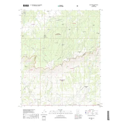
2018 Map of Kehl Ridge
USGS Topo · Published 2018About this map
Washington Park marks the transition between the Tonto National Forest and the Coconino National Forest, centered on the dramatic geological break of the Mogollon Rim. This survey documents a landscape of high-elevation plateaus and steep canyon draws, where the historic General Crook Road and the Arizona National Scenic Trail follow the crest and contours of the rim. The importance of reliable water sources in this arid environment is evident by the numerous named tanks and springs, such as Potato Lake, Geronimo Spring, and the Pieper Hatchery Spring. To the south, the headwaters of the E Verde River emerge below the rim, while the north is defined by prominent ridges like Kehl Ridge and Miller Ridge. The map provides a clear record of forest service infrastructure, including fire control roads and the distinctive feature known as The Tunnel.
Find a feature on this map
96 named features on this map. Tap any name to fly to it.
Don’t see what you’re looking for? This feature index may not catch every label — zoom into the map to look around manually.
Map Details
Editions of this 2018 Kehl Ridge Map
This is the sole edition of this map. No revisions or reprints were ever made.
Other maps of this area

1887 · Verde
USGS Topo · 1:250,000

1892 · Verde
USGS Topo · 1:250,000

1934 · Pine
USGS Topo · 1:62,500

1934 · Promontory Butte
USGS Topo · 1:62,500

1939 · Promontory Butte
USGS Topo · 1:62,500

1940 · Pine
USGS Topo · 1:62,500

1952 · Pine
USGS Topo · 1:62,500

1952 · Promontory Butte
USGS Topo · 1:62,500

1954 · Holbrook
USGS Topo · 1:250,000

1957 · Holbrook
USGS Topo · 1:250,000
Featured Places
- Washington Park, AZ
- Rim Trail Mountain Club Estates, AZ
- Verde Glen, AZ
- Coconino County, AZ
- Gila County, AZ