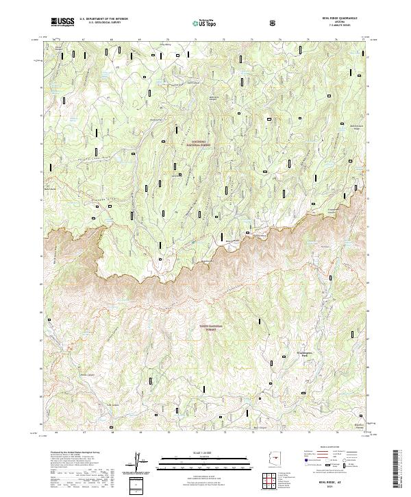
2021 Map of Kehl Ridge
USGS Topo · Published 2021About this map
Mogollon Rim dominates this 2021 landscape, creating a dramatic physical and administrative boundary between the Coconino National Forest and the Tonto National Forest. Near the southern edge of the rim, the small settlement of Washington Park sits at the headwaters of the Verde River, while landmarks like The Tunnel and Hi View Point mark the sharp drop in elevation.
Find a feature on this map
84 named features on this map. Tap any name to fly to it.
Don’t see what you’re looking for? This feature index may not catch every label — zoom into the map to look around manually.
Map Details
Editions of this 2021 Kehl Ridge Map
This is the sole edition of this map. No revisions or reprints were ever made.
Other maps of this area

1887 · Verde
USGS Topo · 1:250,000

1892 · Verde
USGS Topo · 1:250,000

1934 · Pine
USGS Topo · 1:62,500

1934 · Promontory Butte
USGS Topo · 1:62,500

1939 · Promontory Butte
USGS Topo · 1:62,500

1940 · Pine
USGS Topo · 1:62,500

1952 · Pine
USGS Topo · 1:62,500

1952 · Promontory Butte
USGS Topo · 1:62,500

1954 · Holbrook
USGS Topo · 1:250,000

1957 · Holbrook
USGS Topo · 1:250,000
Featured Places
- Washington Park, AZ
- Rim Trail Mountain Club Estates, AZ
- Verde Glen, AZ
- Coconino County, AZ
- Gila County, AZ