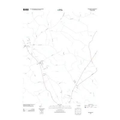
2013 Map of Kelford
USGS Topo · Published 2013About this map
Kelford and Roxobel anchor this Bertie County landscape, positioned along a transportation corridor that bridges the headwaters of the Cashie River. The area is defined by its low-lying hydrology, where Wahtom Swamp and Ahoskie Cr drain the agricultural flats. This survey reveals a traditional North Carolina rural structure, with small-town street grids like Cemetery St and Front St giving way to specialized agricultural and research sites, such as those found along Research Farm Ln. The local road network, including Tyler School Rd and Mill Branch Church Rd, points to the community's historical centers of education and worship. Water features like Mill Br and Sandy Run illustrate the intricate drainage patterns that have historically shaped the placement of farmsteads and timber tracts across this coastal plain region.
Find a feature on this map
71 named features on this map. Tap any name to fly to it.
Don’t see what you’re looking for? This feature index may not catch every label — zoom into the map to look around manually.
Map Details
Editions of this 2013 Kelford Map
This is the sole edition of this map. No revisions or reprints were ever made.
Other maps of this area

1953 · Norfolk
USGS Topo · 1:250,000

1962 · Palmyra
USGS Topo · 1:24,000

1962 · Norfleet
USGS Topo · 1:24,000

1972 · Republican
USGS Topo · 1:24,000

1972 · Woodville
USGS Topo · 1:24,000

1972 · Aulander
USGS Topo · 1:24,000

1973 · Kelford
USGS Topo · 1:24,000

1974 · Rich Square
USGS Topo · 1:24,000

1977 · Union
USGS Topo · 1:24,000

1977 · Woodland
USGS Topo · 1:24,000