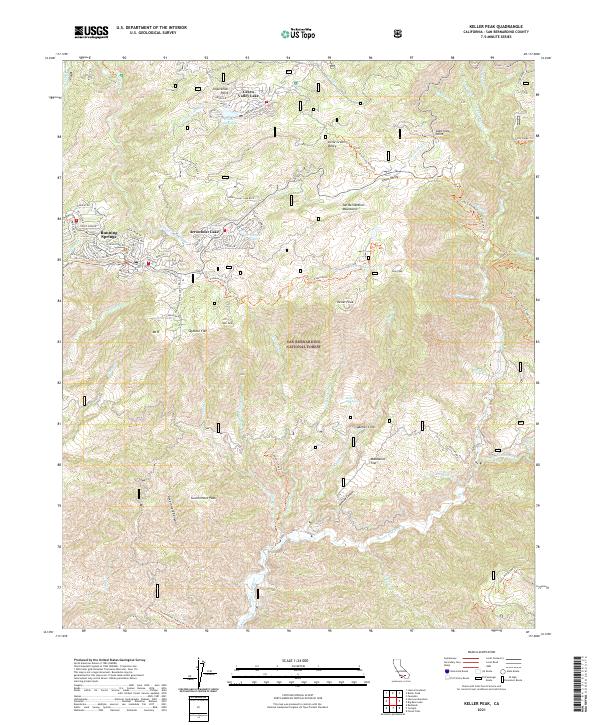
2021 Map of Keller Peak
USGS Topo · Published 2021About this map
The San Bernardino National Forest dominates this highland terrain, where high-altitude communities like Running Springs and Green Valley Lake are joined by the residential clusters around Arrowbear Lake. The landscape is defined by its recreation-driven development, from the ski slopes at Snow Valley to the winding network of residential streets such as Running Springs School Rd and Green Valley Lake Blvd. The presence of the Deep Creek Wild and Scenic River and several drainage systems like Plunge Cr and Alder Cr illustrate the vital watershed role of the San Bernardino Mountains. From the heights of Keller Peak and Inspiration Point down to the sheer Keller Cliffs, the topography showcases the transition from forested lake communities to the canyons feeding the Santa Ana River to the south.
Find a feature on this map
87 named features on this map. Tap any name to fly to it.
Don’t see what you’re looking for? This feature index may not catch every label — zoom into the map to look around manually.
Map Details
Editions of this 2021 Keller Peak Map
This is the sole edition of this map. No revisions or reprints were ever made.
Other maps of this area

1899 · Redlands
USGS Topo · 1:62,500

1901 · Southern California Sheet No. 1
USGS Topo · 1:250,000

1901 · Redlands
USGS Topo · 1:62,500

1902 · Deep Creek
USGS Topo · 1:62,500

1902 · San Gorgonio
USGS Topo · 1:125,000

1904 · Southern California Sheet No. 1
USGS Topo · 1:250,000

1947 · Lucerne Valley
USGS Topo · 1:62,500

1949 · Lucerne Valley
USGS Topo · 1:62,500

1953 · San Bernardino
USGS Topo · 1:250,000
1953 · Harrison Mtn.
USGS Topo · 1:24,000