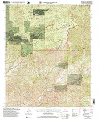
1996 Map of Keller Peak
USGS Topo · Published 1999About this map
Green Valley Lake and the nearby community of Running Springs anchor this mountain landscape in the San Bernardino National Forest during the late 1990s. The map illustrates the specialized recreational development of the era, from the Snow Valley Recreation Area and Green Valley Ski Area to the Calvary Chapel Camp. Transportation is defined by the winding Rim of the World Scenic Byway, which provides access to these high-altitude settlements and overlooks like Inspiration Point.
Find a feature on this map
43 named features on this map. Tap any name to fly to it.
Don’t see what you’re looking for? This feature index may not catch every label — zoom into the map to look around manually.
Map Details
Editions of this 1996 Keller Peak Map
This is the sole edition of this map. No revisions or reprints were ever made.
Other maps of this area

1899 · Redlands
USGS Topo · 1:62,500

1901 · Southern California Sheet No. 1
USGS Topo · 1:250,000

1901 · Redlands
USGS Topo · 1:62,500

1902 · Deep Creek
USGS Topo · 1:62,500

1902 · San Gorgonio
USGS Topo · 1:125,000

1904 · Southern California Sheet No. 1
USGS Topo · 1:250,000

1947 · Lucerne Valley
USGS Topo · 1:62,500

1949 · Lucerne Valley
USGS Topo · 1:62,500

1953 · San Bernardino
USGS Topo · 1:250,000
1953 · Harrison Mtn.
USGS Topo · 1:24,000