
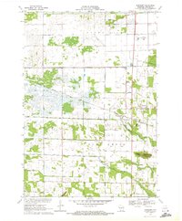
1970 Map of Kellner
USGS Topo · Published 1972About this map
Kellner sits at the intersection of agricultural expansion and infrastructure development on this 1970 survey. The map reveals a landscape heavily managed for drainage and water control, defined by an intricate network of numbered irrigation channels such as Ditch No 4 and Ditch No 5 that crisscross the terrain of Grant. This engineering supports the fields between Buena Vista Creek and Fourmile Creek, showing a transition from the natural wetlands to productive acreage during the late twentieth century.
Find a feature on this map
39 named features on this map. Tap any name to fly to it.
Don’t see what you’re looking for? This feature index may not catch every label — zoom into the map to look around manually.
Map Details
Editions of this 1970 Kellner Map
This is the sole edition of this map. No revisions or reprints were ever made.
Other maps of this area

1955 · Green Bay
USGS Topo · 1:250,000

1957 · Wisconsin Rapids
USGS Topo · 1:48,000

1957 · Whiting
USGS Topo · 1:48,000

1958 · Arkdale
USGS Topo · 1:48,000

1958 · Coloma
USGS Topo · 1:48,000

1967 · Arkdale NE
USGS Topo · 1:24,000

1967 · Wisconsin Rapids
USGS Topo · 1:62,500

1968 · Coloma NW
USGS Topo · 1:24,000

1968 · Hancock
USGS Topo · 1:24,000
1970 · Bancroft
USGS Topo · 1:24,000