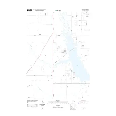
2013 Map of Kelly
USGS Topo · Published 2013About this map
Kelly sits as a quiet focal point in this central Wisconsin landscape, where the meandering course of the Yellow River feeds into the expansive Castle Rock Lake. The topography is defined by significant water management and recreation areas, with the Little Yellow River and the Juneau County Ditch illustrating the long-standing efforts to drain and manage the local wetlands. To the southeast, the geography shifts toward protected natural spaces within Buckhorn State Park, accessible via the Buckhorn Bridge. The road network, including State Road 80 and State Road 58, anchors the rural residential developments like those along Morro's Mile Rd, showing the area's modern character as a mix of agriculture and lakeside retreat.
Find a feature on this map
68 named features on this map. Tap any name to fly to it.
Don’t see what you’re looking for? This feature index may not catch every label — zoom into the map to look around manually.
Map Details
Editions of this 2013 Kelly Map
This is the sole edition of this map. No revisions or reprints were ever made.
Other maps of this area

1921 · Mauston
USGS Topo · 1:62,500

1953 · Eau Claire
USGS Topo · 1:250,000

1955 · Green Bay
USGS Topo · 1:250,000

1957 · Madison
USGS Topo · 1:250,000

1958 · Eau Claire
USGS Topo · 1:250,000

1958 · Arkdale
USGS Topo · 1:48,000

1958 · Necedah
USGS Topo · 1:48,000

1958 · La Crosse
USGS Topo · 1:250,000

1960 · Madison
USGS Topo · 1:250,000

1961 · La Crosse
USGS Topo · 1:250,000