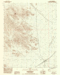
1983 Map of Kelso
USGS Topo · Published 1985About this map
Kelso sits as a critical junction for the Union Pacific railroad in this arid expanse of the eastern Mojave. The town's infrastructure is clearly defined by a protective Levee and the presence of a Cem, reflecting the permanent footprint of the rail workers and their families. To the west, the Marl Mountains dominate the terrain, rising to the prominent Kelso Peak. The landscape is etched by drainage systems like Kelso Wash and Cedar Wash, which reveal the hydrological patterns of this desert environment. Signs of human industry and range management appear throughout the quadrangle, including a Prospect for mining and a Corral for ranching. Utility and transit are marked by the presence of Water Res and the transit corridors of Kelbaker Road and Cima Road.
Find a feature on this map
16 named features on this map. Tap any name to fly to it.
Don’t see what you’re looking for? This feature index may not catch every label — zoom into the map to look around manually.
Map Details
Editions of this 1983 Kelso Map
2 editions found
Other maps of this area

1910 · Ivanpah
USGS Topo · 1:250,000

1912 · Ivanpah
USGS Topo · 1:250,000

1942 · Ivanpah
USGS Topo · 1:250,000

1942 · Amboy
USGS Topo · 1:250,000

1943 · Amboy
USGS Topo · 1:250,000

1947 · Kingman
USGS Topo · 1:250,000

1948 · Kingman
USGS Topo · 1:250,000

1954 · Needles
USGS Topo · 1:250,000

1954 · Kingman
USGS Topo · 1:250,000

1955 · Kingman
USGS Topo · 1:250,000