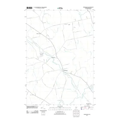
2011 Map of Kenduskeag
USGS Topo · Published 2011About this map
Kenduskeag Stream serves as the central drainage for this Penobscot County landscape, flowing past the clustered settlements of Kenduskeag, Robyville, and Higginsville. The map documents a rural transition where traditional stream-side developments meet the rising prominence of the road network, including the Robyville Bridge and routes leading toward South Corinth. Family and community history is anchored by the Evergreen Cemetery near the center of the sheet and Waugh Cemetery to the southwest. The terrain is characterized by low-lying wetlands like Beaver Meadow and the winding courses of Pushaw Stream and Black Stream, while Hudson Hill provides a modest topographic break in the northern section. These features suggest a long history of small-scale agriculture and river-dependent industry common to this part of Maine.
Find a feature on this map
70 named features on this map. Tap any name to fly to it.
Don’t see what you’re looking for? This feature index may not catch every label — zoom into the map to look around manually.
Map Details
Editions of this 2011 Kenduskeag Map
This is the sole edition of this map. No revisions or reprints were ever made.
Other maps of this area

1902 · Bangor
USGS Topo · 1:62,500

1931 · Stetson
USGS Topo · 1:48,000

1932 · Dover-Foxcroft
USGS Topo · 1:48,000

1933 · Boyd Lake
USGS Topo · 1:62,500

1935 · Dover-Foxcroft
USGS Topo · 1:62,500

1935 · Stetson
USGS Topo · 1:62,500

1942 · Bangor
USGS Topo · 1:62,500

1946 · Bangor
USGS Topo · 1:62,500

1948 · Bangor
USGS Topo · 1:250,000

1951 · Boyd Lake
USGS Topo · 1:50,000