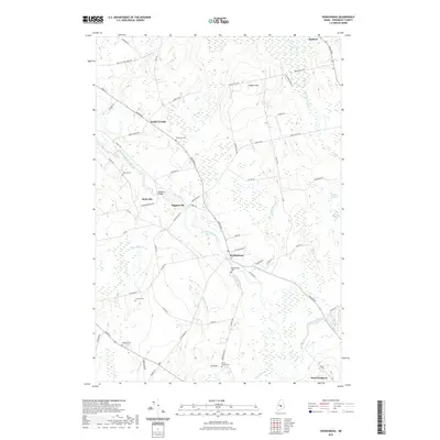
2021 Map of Kenduskeag
USGS Topo · Published 2021About this map
Kenduskeag Stream serves as the central geographic artery for this portion of Penobscot County, flowing past the namesake village of Kenduskeag and the historic Robyville Bridge. The landscape is a network of small, established settlements like South Corinth, Higginsville, and West Glenburn, many linked by the prominent corridor of Broadway. Genealogy researchers will find significant value in the distribution of family-named burial grounds across the area, including Hilltop Cem, Evergreen-Cem, and Jerrard Cem. The terrain is characterized by low-lying wetlands such as Halfmoon Meadow and Marston Meadow that flank the drainage basins of Lancaster Brook and Baker Brook. This modern topographic survey reveals how historic local roads and rural infrastructure have persisted into the twenty-first century while maintaining their traditional pastoral layout.
Find a feature on this map
70 named features on this map. Tap any name to fly to it.
Don’t see what you’re looking for? This feature index may not catch every label — zoom into the map to look around manually.
Map Details
Editions of this 2021 Kenduskeag Map
This is the sole edition of this map. No revisions or reprints were ever made.
Other maps of this area

1902 · Bangor
USGS Topo · 1:62,500

1931 · Stetson
USGS Topo · 1:48,000

1932 · Dover-Foxcroft
USGS Topo · 1:48,000

1933 · Boyd Lake
USGS Topo · 1:62,500

1935 · Dover-Foxcroft
USGS Topo · 1:62,500

1935 · Stetson
USGS Topo · 1:62,500

1942 · Bangor
USGS Topo · 1:62,500

1946 · Bangor
USGS Topo · 1:62,500

1948 · Bangor
USGS Topo · 1:250,000

1951 · Boyd Lake
USGS Topo · 1:50,000