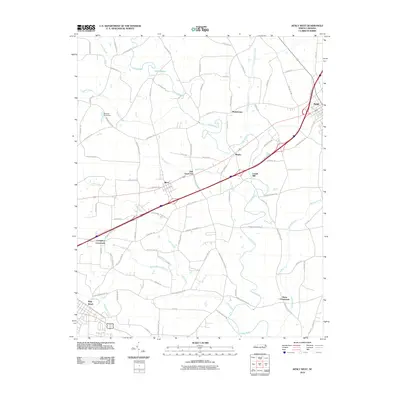
2010 Map of Kenly West
USGS Topo · Published 2010About this map
Pine Level and Micro anchor this Johnston County landscape, which shows a sophisticated network of local roads and watercourses just before the 2010s. The Little River and its various tributaries, including Buffalo Creek and Little Buffalo Creek, define the drainage patterns of the region. The map reveals the placement of historic junctions such as Crumplers Crossroads and Rains Crossroads, which continue to serve as local landmarks. The presence of Lowell Mill and Oak Grove Inn points to established community nodes along the transportation corridors. Significant infrastructure like the Browns Pond Dam and the Johnston Pkwy illustrate the intersection of water management and modern highway development across this North Carolina coastal plain area.
Find a feature on this map
85 named features on this map. Tap any name to fly to it.
Don’t see what you’re looking for? This feature index may not catch every label — zoom into the map to look around manually.
Map Details
Editions of this 2010 Kenly West Map
This is the sole edition of this map. No revisions or reprints were ever made.
Other maps of this area

1902 · Kenly
USGS Topo · 1:62,500

1903 · Kenly
USGS Topo · 1:62,500

1906 · Four Oaks
USGS Topo · 1:48,000

1908 · Four Oaks
USGS Topo · 1:62,500

1953 · Raleigh
USGS Topo · 1:250,000

1954 · Raleigh
USGS Topo · 1:250,000

1964 · Flowers
USGS Topo · 1:24,000

1964 · Selma
USGS Topo · 1:62,500

1964 · Selma
USGS Topo · 1:24,000

1974 · Northwest Goldsboro
USGS Topo · 1:24,000