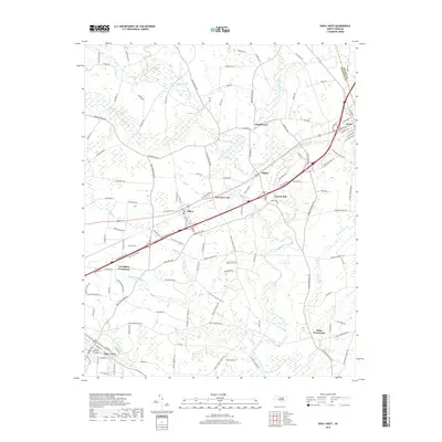
2019 Map of Kenly West
USGS Topo · Published 2019About this map
Pine Level and Kenly anchor this Johnston County landscape, which is defined by a dense network of rural roads and small settlements that emerged along the regional drainage systems. The Little River and its various tributaries, such as Buffalo Cr and Little Cr, create a low-lying topography where agricultural land is segmented by wooded creek bottoms. The spatial relationship between towns like Micro and Bagley reveals a historical reliance on local milling and road junctions, illustrated by features like Lowell Mill and Oak Grove Inn. Further out, named intersections such as Crumplers Crossroads and Rains Crossroads represent the enduring centers of these farming communities. The survey also captures the boundary between Johnston Co and Wilson Co, showing how local infrastructure bridges these political lines near the settlement of Beulahtown.
Find a feature on this map
131 named features on this map. Tap any name to fly to it.
Don’t see what you’re looking for? This feature index may not catch every label — zoom into the map to look around manually.
Map Details
Editions of this 2019 Kenly West Map
This is the sole edition of this map. No revisions or reprints were ever made.
Other maps of this area

1902 · Kenly
USGS Topo · 1:62,500

1903 · Kenly
USGS Topo · 1:62,500

1906 · Four Oaks
USGS Topo · 1:48,000

1908 · Four Oaks
USGS Topo · 1:62,500

1953 · Raleigh
USGS Topo · 1:250,000

1954 · Raleigh
USGS Topo · 1:250,000

1964 · Flowers
USGS Topo · 1:24,000

1964 · Selma
USGS Topo · 1:62,500

1964 · Selma
USGS Topo · 1:24,000

1974 · Northwest Goldsboro
USGS Topo · 1:24,000