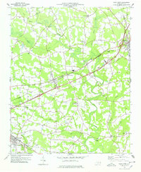
1978 Map of Kenly West
USGS Topo · Published 1978About this map
Kenly and Micro anchor the rail-driven landscape of eastern Johnston County in the late 1970s, where the Seaboard Coast Line and Southern railroads intersect the rural Piedmont topography. The winding course of the Little River serves as the primary drainage, joined by several family-named tributaries like Buffalo Creek and Moccasin Creek. This era reveals a well-established network of community centers, from the industrial site at Lowell Mill to scattered crossroads like Crumplers Crossroads and Rains Crossroads. Local history is deeply etched into the map through numerous small churches and cemeteries, such as Holly Springs Ch and Bethany Ch, which alongside Oak Grove Inn and North Johnston High Sch, provide clear geographic markers for genealogy and local heritage research.
Find a feature on this map
38 named features on this map. Tap any name to fly to it.
Don’t see what you’re looking for? This feature index may not catch every label — zoom into the map to look around manually.
Map Details
Editions of this 1978 Kenly West Map
This is the sole edition of this map. No revisions or reprints were ever made.
Other maps of this area

1902 · Kenly
USGS Topo · 1:62,500

1903 · Kenly
USGS Topo · 1:62,500

1906 · Four Oaks
USGS Topo · 1:48,000

1908 · Four Oaks
USGS Topo · 1:62,500

1953 · Raleigh
USGS Topo · 1:250,000

1954 · Raleigh
USGS Topo · 1:250,000

1964 · Flowers
USGS Topo · 1:24,000

1964 · Selma
USGS Topo · 1:62,500

1964 · Selma
USGS Topo · 1:24,000

1974 · Northwest Goldsboro
USGS Topo · 1:24,000